Introduction | Tank – How to | Tank – Examples | Atmosphere – The Polar Front | Atmosphere – Synoptic Fronts | Theory | For Teachers | Wiki
In the atmosphere, the transition from warm, equatorial air to cold polar air is not gradual, but occurs rather abruptly in mid-latitudes where tropical and polar air masses meet at the polar front. Everyday weather is often associated with undulations of this frontal surface. Here we will study the observed synoptic-scale fronts that develop on the polar front.
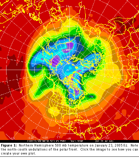
The following figure shows the Northern Hemisphere 500 mb temperature on January 23, 2005 0z. Note the north-south undulations of the polar front, marked by the transition from orange to green color.
Meanders of the frontal region are associated with high and low pressure synoptic systems which develop on the polar front. You can view a short movie of storm systems forming along the polar front in the northern hemisphere here nh_wv_loop.
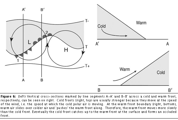
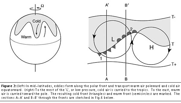
The surface manifestations of these systems are warm and cold fronts, as sketched below. Note that in mid-latitudes, eddies form along the polar front (left) and transport warm air poleward and cold air equatorward. (right) To the west of the ‘L’, or low pressure, cold air is carried to the tropics. To the east, warm air is carried toward the pole. The resulting cold front (triangles) and warm front (semicircles) are marked. The sections A-A’ and B-B’ through the fronts are sketched in the final figures on this page.
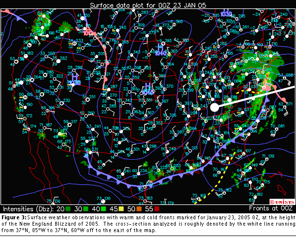
We will now study vertical cross-sections across the cold and warm fronts of one of these mid-latitude low pressure systems and analyze the temperature and wind fields associated with these storms. The diagram below shows the surface weather observations with warm and cold fronts marked for January 23, 2005 0Z, at the height of the New England Blizzard of 2005.
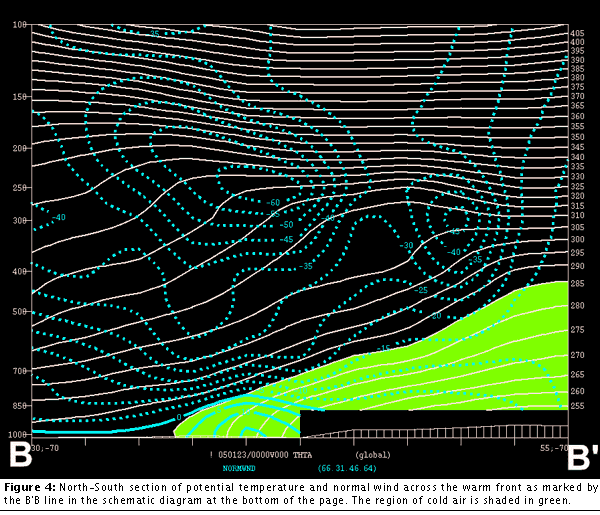
The following section is a North-South section of potential temperature and normal wind across the warm front as marked by the B’B line in the schematic diagram at the bottom of the page. The region of cold air is shaded in green.
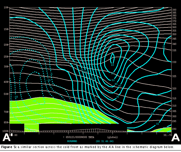
The figure below show a similar section across the cold front as marked by the A’A line in the schematic diagram. According to thermal wind, in both sections, pronounced vertical wind shear are associated with horizontal gradients in temperature.
The figure below shows schematic vertical cross-sections marked by line segments A-A’ and B-B’ across a cold and warm front. Note that cold air wedges underneath the warm air in the case of the cold front, while warm air overrides cold air in the warm front. In both cases, warm, moist air rises, cools and condenses, forming clouds and precipitation along the fronts. Because the cold fronts are usually stronger than the warm fronts, the precipitation associated with the passage of a cold front is usually heavier than in a warm front.